


Sommartel

Cardinje
User

Length
11.1 km

Max alt
1310 m

Uphill gradient
377 m
Km-Effort
16.1 km

Min alt
1023 m

Downhill gradient
376 m
Boucle
Yes
Creation date :
2019-04-05 13:45:26.165
Updated on :
2019-04-05 13:45:26.313
3h24
Difficulty : Medium

FREE GPS app for hiking
 SityTrail
IGN / Geographical institutes
SityTrail Plus
The world is yours!
About
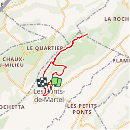
Trail Walking of 11.1 km to be discovered at Neuchâtel, Unknown, Les Ponts-de-Martel. This trail is proposed by Cardinje.
Positioning
Country:
Switzerland
Region :
Neuchâtel
Department/Province :
Unknown
Municipality :
Les Ponts-de-Martel
Location:
Unknown
Start:(Dec)
Start:(UTM)
327586 ; 5207680 (32T) N.
Comments